Monday, 14 November 2011

London Loop: Section 4: West Wickham Common to Hamsey Green

Realise I have been a little slack and have not written about these two walks yet even though I did them one and two months ago. Leg 4 from West Wickham Common to Hamsey Green starts with a long link section that goes up and down along  a fenced path. I remember this from the previous walk where I was pretty tired and this long and rather dull link at the and was the last thing I needed. More suburban street walking follows until you reach an old church with fine views over wooded countryside. The next section through sports fields leads to a steep climb up to and through woodland. All still in leaf at this point and including sweet and horse chestnuts, oaks, hazels and even an almond. Nut-tastic! As you emerge from the Theehalfpenny Wood you get a good view back to London including a glimpse of the Shard which is now almost complete. This building near London Bridge station has been one of the landmarks of the LOOP so far as for several legs London Bridge station has been my starting point.

The path then meanders through more meadows before climbing up to the viewpoint on Addington Hill. From here on a clear day you can get a fantastic panorama of the London skyline. Today was a bit overcast but the view was still pretty good. It would have been better if someone hadn't stolen all the brass identification plates so I could have known what I was looking at!

View from Addington Hill
I could identify the Shard, Docklands, Gherkin and a windmill in Shirley. Descending through a nice park you then emerge back into the suburbs and my first encounter with Croydon's tram system. Quite an extensive network and quite quiet so you may not notice them coming! More pleasant open space and woodland follows until you arrive at the small hamlet of Hamsey Green where I picked up a bus back to Croydon. Took a tram back to Wimbledon for a change of pace rather than a mainline train back to the city.


Sunday, 28 August 2011

Two Welsh Walks: 2 - A Circular Walk From Moelfre


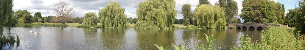
This walk, about 4 or 5 miles, contains everything that is interesting about Anglesey. It starts with a stretch along the Anglesey coastal path heading north. It is best to avoid the car park by the harbour as it is: 1. Small. 2: Expensive: 3: Difficult to get out of as it is very busy! Unlike the walk from Cemaes Bay the path is wide and climbs and descents are gentle. The rocks are different as well, gently dipping beds of massively bedded limestone. It is also a coast of wrecks and signs of this are apparent in this part of the walk. At least two monuments to wrecks stand on the coast and there is a museum dedicated to the lifeboat and their crews just outside of Moelfre.

The path passes a small, low island covered with sea birds and leads eventually to the wide sandy Ligwy Bay. Despite it being the height of the school holidays the beach was not crowded and there was a welcome bothy selling ice-creams which made for a satisfying break before heading away from the coast and along a series of quiet inland lanes.

Along this stretch of the walk you see signs of human habitation from the eolithic to the Middle Ages. First you see the ruins of Chapel Hen, a chapel of ease. Most was built in the 12th century but extensions, including a 16th century burial vault (great for all you D&D enthusiasts out there). Now it is a roofless ruin but the setting is very striking.

From here you walk into the woods and find the ruins of a Romano-British settlement. The stone walls of two circular dwellings and several more rectangular buildings on a low hill surrounded by a wall built probably to keep animals in rather than invaders out. The larger rectangular buildings are thought to be workshops and barns, the circular buildings living quarters. A striking site and well worth a visit. From here the lane leads to third, final and by far the oldest site. A huge capstone set on a circle of smaller stones. The remains of twenty or more men, women and children have been excavated from here and dated to about 2500-3000BC.
From here the walk returned to Moelfre via field paths and some very steep stiles until the welcome site of Ann's Pantry hove into view where a much needed cup of coffee and a slice of cake set us up for the drive back to the cottage.

Two Welsh Walks: 1 - Cemaes Bay to Bull Bay


This walk is part of the Anglesey Coastal Path and as such is clearly signed. On top of that being a coastal path finding the route is dead easy: you just keep the sea on your left and you can't go wrong.
The walk starts in the tidy little village of Cemaes which has a lot of useful shops including a Post Office, vital when you are on holiday and needing to send post to relatives around the world. This is a linear walk, I was dropped off at the start and my wife drove to the Bull Bay Hotel where I would be picked up later (after an obligatory pint (for medicinal purposes only of course)).
Cemaes Bay itself is a striking example of Precambrian geology with folded and twisted rocks of great age. Part of a subduction zone (a destructive plate boundary where one plate is forced beneath another and destroyed, often forming a volcanic island arc in the process). As an ex-geologist this was a particularly interesting part of the walk for me. The path climbs steeply up beside the coast and for much of the route it is very narrow with little separation between the path and the sea some hundred or so feet below.

The route is about six or seven miles in length but it feels a lot longer as there are a number of steep climbs and descents most of the time with steep rough steps but sometimes not. After about the fourth of these climbs my lungs were burning and my head throbbing – walking the London Loop is one thing – tough coastal paths are something else!
There are many signs of industry round the walk, in particular the remains of a wharf and extensive buildings at Porth Wen.


These are the remains of a brickworks I learnt from the barmaid of the Bull Bay Hotel. From this point the path becomes more level and wide making the going easy and at last I was able to enjoy the views of the coast and the heather coated slopes inland. Keep your eyes pealed for wildlife; I think I saw a seal in one of the coves and porpoises are said to swim offshore. Birds are common too; I saw oyster catchers in Cemaes Bay and a kestrel perched on a fence post about twenty paces away from me at one point. I think he was waiting for me to keel over and flew away when he realised I was not going to be supper! There are plenty of viewpoints suitable for a packed lunch, in particular the Lookout Tower on Llanlleiana Head. The walk, though tough in places is well worth the effort and I felt that I had earned my pint at the end.

Saturday, 16 July 2011

London Loop: Section 3: Petts Wood to West Wickham Common

Weather: Hot and Sunny
Playlist: LastFM Playlist
Time: 3.5 Hours  (plus a 1/2 hour lunch break)

I chose a gloriously sunny July day to walk the ten miles between Petts Wood and Hayes stations. After a relatively long link through suburban streets you join the main route through a wild flower strewn heath a sign of things to come. After more suburban walking (one of the advantages of walking at this time of the year is that I can see what other people grow in their front gardens). The next part is the first of many attractive woodland sections on this leg of the Loop. I like the smell of woodland, the smell of damp rotting wood is comforting when you are out of doors (but not when you are poking around in your house). After crossing the busy A232 and the A21 you arrive in Farnborough. An attractive village but no time to stop as there is a gentle descent alongside woodland to the High Elms Country park. This section boasts wide open skies and gently rolling downland with dense woodland to your left. I kept in the shadows as it was now very hot!
I got a little lost in the grounds of the High Elms Country Park and ended up at the very nice cafe in the grounds - they do a very nice sausage sandwich as well as a selection of other hot and cold meals and drinks - worth a visit if you time your arrival for around lunchtime as I did!
Poppies amongst the grain
Moving on the landscape becomes more and more unlike anything you would think was within an hour or so of London. Walking along Bogey Lane you have fields of grain spattered with crimson poppies and on the crest of a rise Holwood House.

I love silly names!

A gentle, but long, climb leads you up past the Wilberforce Oak (where Wilberforce and Pitt debated the abolition of the slave trade) and gives you more views across the countryside.
Descending towards Keston you pass a string of lakes and a brick lined spring. The water was surrounded by fishermen and the water was alive with dragon and damsel flies. The spring in its modern brick lined surround has not lost any of the magic that is associated with such features. People have probably been taking water there for hundreds if not thousands of years.
Past the lakes, more forest walking but the sounds of the road traffic is never far away. All too soon there is another long link to the station at Hayes, mostly uphill and quite tiring especially as there was the long train journey back to Greenford to look forward to.

Sunday, 26 June 2011

London Loop: Section 2: Old Bexley to Petts Wood

Weather: Fine, sunny and warm
Playlist: LastFm Playlist
Time: 2.5 Hours

Bit of a delay blogging this walk - busy times at work. However this was a fantastic walk and I would heartily recommend it to anyone. Although not as long as some sections it crams in a lot of attractive features. The walk starts out from the attractive Old Bexley that I'm sure would repay more time exploring than I gave it. Soon after leaving Bexley you head up over a grass covered waste dump, no don't turn back, this was filled with wild flowers and several skylarks that danced in the air and sung in the summer sun. Fantastic. There were clumps of wild fennel with beautiful bronze fronds some 3 feet high beside the track and again it was hard to believe that this was London not somewhere wilder. The path then goes past cricket pitches where a host of youngsters were playing various forms of cricket. One young girl thwacked a ball almost over the fence as I was passing so take care on this leg if you are walking in the summer!
The next section is alongside the River Cray which here is very pretty and filled with little brown fish. My fish identification skills are even worse than my bird spotting talents so I can't tell you what they were! The Cray is held back by a weir under the attractive Five Arch Bridge and spreads out into a placid lake upon which swans with cygnets along with coots and moorhen with their young paddle around.
Five Arch Bridge
The path continues along the river through the meadows past the attractive Sidcup Place before negotiating the junction of the A20 and A222 - a bit of a maze but well signposted so I didn't get lost. Most of the rest of the walk is then in dappled shade through mixed woodland, up and down hill along clear paths possibly some of my favourite walking. The woods were full of jays (or the same one that kept coming back and flying past again).
The last part for the walk gave views over rolling hills with sheep grazing in the sun. Great stuff and can't wait for the next leg in early July.

Thursday, 5 May 2011

Capital Ring: Section 6, 7 & 8: Richmond Bridge to the Summit of Horsenden Hill

Weather: Hot and sunny

Time: 6 hours including a stop for a relaxed lunch and a browse around some craft stalls!

This was probably the best leg of the whole Capital Ring! The variety of walking, town streets, river side, canal tow path and open country, the weather and the fact that I had my wife and some friends along all contributed to the pleasure.
The walk starts in Richmond and takes you along the river Thames before walk through the grounds of Syon House (which has a fine garden centre for those interested) leads you to historic Brentford. Here you follow the Grand Union canal which was alive with bird life including goslings and a three way tug of war between a group of coots and a length of weed as they tried to build a nest.

Just before the path leaves the canal we stopped off at the Fox at Hanwell. The food and choice of guest ales were brilliant and there were craft stalls outside for my wife to browse! As this was the day of the Royal Wedding the street outside was packed with trestle  tables and a very convivial atmosphere as people celebrated with music and lots of food.

The path then follows the river Brent for a time before joining a different branch of the canal which takes you to the path to the summit of Horsenden Hill. The view from the summit, despite the smoggy haze was a great reward for all the efforts.

OK - Time for a lap of honour!

Throughout this leg I was surrounded by fantastic wildlife and plants, I was walking at the best time of the year but even so it was a constant delight and a reminder that no matter what people say about LOndon and the suburbs, there are many worse places to live and walk in!

Monday, 11 April 2011

London LOOP: Leg 1 - Erith to Bexley

Weather: Very warm, clear blue skies, gentle breezes

Playlist: LastFm Playlist

Time: 3 Hours

Started the London LOOP this week even though I haven't finished the Capital Ring yet - that will come later this month. Spring has definitely sprung here in East London with bluebells and white wood anemones in the shady woodlands on the field paths to Bexley and blossom of all colours on the cherries and hawthorn trees in the woods and on the streets.

The walk starts at Erith which with the wide river front and the bunting has a fee of a seaside resort - very odd but quite attractive.
Erith Riverside

Further on the walk makes its way alongside some of the many creeks and channels that run into the Thames. In the bright sunshine the mudflats had the colour and texture of hammered silver and the fields on either side were full of skylarks dancing and singing until they were fit to burst. Swans and dugs floated down the shallow streams while ponies grazed beside the numerous scrap yards  recycling facilities. One of these facilities had a rather odd sign.

Odd - What would Lucy say?

The next section ran beside the River Cray which had a very peaceful feel despite running behind a long row of houses. It then runs past an old country manor before taking a short but scary trip alongside the very busy A2!
Not the most scenic part of the route
After this the path runs alongside woodland filled with bluebells and anemones with thrushes and tits singing in the trees.
It finally emerges into the village of Bexley with its interestingly spired church.

Bexley Church