Showing posts with label River. Show all posts

Sunday, 4 June 2023

Walking the Thames Path: Section 6.1: Culham to Dorchester


Weather: Sunny, Very Warm
Section Length: 13.5Km
Fantastic Place: Dorchester Abbey Tea Room


The Route

A very sunny day for this section of the Thames Path.Lots of wild flowers everywhere along with birds and insects - in particular mayflies and dragonflies. After being dropped off in the sleepy village of Culham the first stretch of the walk is beside wild flower strewn meadows alive with mayflies. Flying above red kites and buzzards circle looking for prey.

Shortly after passing under the railway bridge there is a WWII pillbox. Not sure what it would have been guarding. There is another at the end of the walk on the approach to Dorchester so I guess they were there to defend the river. Now this one would make a good bird hide as flocks of geese were grazing on the grass in front of it.

    
Pillbox.

In several sections, the main, winding path of the Thames are bypassed by cuts, and at the entry and exit of each there is a weir <shudder>. 

At the end of the Clifton Cut there is a fine lock keeper's cottage. The gardens are very well tended (and there is an option of purchasing an ice cream if you fancy it).

Clifton Lock
 

Shortly after the lock you come to one of the most attractive bridges on the river, this one was designed by Sir George Gilbert Scott.

Clifton Hampton Bridge

Crossing the bridge for a short detour you I walked to the Barley Mow, a thatched pub built in the 14th Century and mentioned in Three Men in a Boat

The Barley Mow

Back to cross the busy bridge (busier than normal as there was a road closure that caused Liz to get diverted, ironically, past this spot) and back along the Thames. The houses on the far bank of the river are very large and look very expensive. Some of the boathouses probably cost more than our house.

Modern Boathouse

Modern Riverside Residence

 This stretch of the Thames has some environmental management programs in place. Side channels and pools to support wildlife include snipe and otters. The meadows were full of buttercups glowing in the sun. The long curve of the river bends round to the south giving great views of the hills south of Dorchester, one of which is capped with an Iron Age Hill Fort.

Wittenham Clumps

Cows modelling for a Cuyp Painting

Buttercup Meadows


One final weir leads to the final stretch and a return to Dorchester alongside the Thame. The gardens of Dorchester Abbey are worth a look at and if you are there in the afternoon the Abbey Tearooms provide a fine selection of cakes. I had a well deserved slice of Lemon Drizzle and one of Orange Fruitcake. Both were very tasty. There is also a small museum in the old abbey guest house that is worth a look.


Wednesday, 15 May 2019

Walking The Thames Path: Section 1: Source to Cricklade


Weather: Sunny, Very Warm
Section Length: 19.7km
Fantastic Place: Ashton Keynes


The Route
Background
The Thames has played a large part in my life. I've lived in London for over half my life now and most of the IT projects and companies I've worked for have been on or near the Thames. My family grew up in Stroud so the Cotwolds were often a holiday destination for me as a child and I still visit there today to see some of those relations that didn't emigrate to Australia. Given that it is a bit strange that I have not formally walked any of the Thames Path. Sure I've walked part of in while going to work, visiting galleries and museums and some sections formed part of the LOOP, especially out towards the east of the city. As a supplement to my Walking the Lines project, I thought I could add the Thames Path to my list of walks. It is unlikely that I will walk it in any structured way, or in any particular order. The western sections will be done while on holiday in the Cotswolds while the London sections will be done possibly during the winter, hopefully dragging Liz along with me.
However, it seemed to make sense by starting the project with the first section while we were on holiday in Stroud.

Finding the Source
A journey of 294km starts with a single step or so they say and this first step was taken in the carpark of the Thames Head pub where Liz dropped me off so she could enjoy a day of browsing and letter writing in Cricklade where I would meet her later. So the start of the walk was alongside the rather busy A433 which follows the line of the Roman Foss Way. Glad to be off the major road I was then confronted with a foot crossing across a high-speed railway line. Fortunately, views in both directions were good and I was able to cross without difficulty. During my walk along the LOOP, I occasionally had to cross busy roads at the end of a long walk and getting any sort of sprint at that stage was much harder!

The path to the source of the Thames is unclear and there was no sign of any water, just a lot of cows. Then I glimpsed in the distance a stone block that looked promising and soon I was standing at the official source of the Thames.
It's all downhill from here.

Move along, nothing to see here.
 A small depression lined with stones which occasionally after a very wet season will contain the start of the Thames. Looking back along the meadow I could just make out a small dip that would be the path of this infant stream that eventually flows out into the sea nearly 300km to the east.

After dribbling a few drops of water from my bottle onto the stones I headed off east. The meadow was full of cows and the surrounding fields golen with oil seed rape.

Spot the Thames

None Shall Pass

Liquid Gold

The path leads back to the Foss Way and on the other side the path of the Thames is better defined and you can imagine water in it if there had been a wetter winter and spring than the one we had this year.


Just a few hundred paces after the road I could see water in the stream bed. The famous Lyd Well is often the first point where water reliably bubbles up into the Thames. A bit further on the Thames had become a proper stream, shallow and wide but flowing over a pebbly bed and crossed by a bridge.

First Proper Bridge

The Infant Thames
The Lakes of Ashton Keynes
The path follows the meandering stream closely for the next few kilometres through woodland redolant with wild garlic, past ponds with flag iris lining the banks and under powerlines striding across the landscape.


The pretty village of Ashton Keynes is surrrounded by numerous lakes, created by gravel extraction and now flooded and used for fishing and other leisure activities. Some of these lakes are fringed with gated communities and there are a lot of Private signs that don't add up to a relaxing walk. Ashton Keynes itself is a small but very pretty Cotswold stone village where the Thames flows through a stone lined channel, the first sighting of the river for some time, the channel having been swallowed up by the lakes, and the last for a while as more lakes follow on the otherside of the village.


The Thames near Ashton Keynes
At this point I was getting a little tired of the zig-zagging between the lakes but I was amused to see a sign warning of quicksand!
Cricklade - Twinned with Mos Eisley
We had visited Cricklade once a couple of years before as we drove back to London from an Autumn break. When I pointed out the young Thames Liz wouldn't have it, until I pointed out a plaque on the bridge. Before this walk Liz read me a section of William Cobbett's "Rural Rides" where he described Cricklade in 1821 as "a more rascally looking place I never set my eyes on." All I can say is that he had not been out much! The approach to this small town is across a wonderful wildflower strewn meadow which has been protected as a wildlife reserve since the 1970s. Cricklade itself is quite pretty with a number of historic pubs, some useful shops and a very nice cafe where I had a welcome drink and late lunch with Liz while I considered when I'd be able to tackle the next section down to Lechlade.


Sunday, 1 May 2016

Tracking the Tube: Northern Line 04: Mill Hill East to High Barnet


Weather: Warm sunshine with cold winds
Distance Walked: 13.12km 
Distance By Tube: 7.60km
Stations Visited: 6
Fantastic Place: Mill Hill Viaduct

The bright blue skies in the photos might make you think the weather was warmer than it was! As soon as I was in any sort of exposed position the strong chill winds cut through my jacket, but when sheltered I wanted to take it off as it was too warm. 
Lots of blossom and fresh green leaves sprouting on the trees and the air was full of the smell of spring.

Mill Hill East station has the feel of a countryside station. Very quiet and a single track with a platform just on one side. It is, according to its Wiki page the least used station on the Northern Line and it feels sleepy and peaceful so different to the hustle and bustle of the central portion of this line.

Just after leaving the station, passing a very large and new looking Waitrose store, the route goes under the Dollis Brook Viaduct over which the tube runs to the station. It soars 18m above the road on slender brick arches and was worth travelling out to see.

Finchley Central station continues the theme of this part of the line with stations built from an attractive pale brick.

The next section of the walk heads north east along the busy shopping street of Ballards Lane. Half way along I passed Leisure Games provider of Role Playing Games and accessories. I've shopped here via the internet for many years as well as various Dragonmeet shows. Turning north west towards West Finchley I was now on the High Barnet branch after completing the spur from Mill Hill East. I don't know this part of London at all and one of the best things with this series of walks is discovering new and very attractive parts of London.


Dollis Brook Greenwalk
After West Finchley the route joins the delightful Dollis Valley Greenwalk. Apart from dropping off the path to visit the stations the route follows the Greenwalk for most of the rest of the way to High Barnet. The Dollis Brook isn't a large stream, even after all the recent rain, but it pretty and it meanders through grassy fields and light woodland. 
Early Oak Leaves

Lots of dog walkers, cyclists (on their own dedicated path) and birds in the trees along this stretch. It is places that this that would surprise some people that everything inside the M25 is concreted over and polluted.

Leaving the Greenwalk as it reaches the playing fields near High Barnet and after a short road section I arrived at the end of this section.

Next tube walk will be the final one along the Northern Line heading north from Camden Town towards Edgware via Hampsted.


I wonder if my rope's still hanging from the tree


Peacock Path


Sunday, 12 February 2012

London Loop: Section 8: Donkey Wood to Uxbridge Lock

Kingfisher on the River Colne
I wonder if my rope's still hanging from the tree
By the standing pool where you drank me
And filled me full of thirsty love
And the memory of water?

I wonder if a king still fishes there
His back towards the burned-out air
His laughing catches singing loud
The memory of water

- Marillion, Memory of Water

I don't think I have every been so cold as this, even being snowed in on a concert tour of North Germany where the River Wesser froze over and we had snow drifts a dozen feet thick piled up against the youth hostel walls can compare. I must be getting soft in my old age. This walk starts, like the last one finished, with a dreary walk alongside the A30 with jumbo jets and huge A380's blasting off from Heathrow over my head but soon you turn off and join the river Crane again. Just before that however, parked next to one of the giant British Airways' hangers was a Concord. Still as brilliantly different as ever but looking rather sad and lonely. I remember having to pause my lessons at about 11am each day as Concorde took off from Heathrow not far from the school I taught at.

The snow that fell earlier in the week was still lying on the ground and any muddy patches were frozen into rock hard ridges and my mood was lifted by spotting a fox that paused to study me ahead on the path and a falcon perched on a broken branch above my head. I wonder if they were both hunting the rabbits I saw a few moments later bounding across the path to find cover in the brambles? I love the wildlife I see on the walk and this gave me hope that this was going to be a good leg, despite the cold!

Despite the early part of the walk following the A30, crossing the A4 and diving under the M4 the walk felt very rural as it tracked the meandering River Crane with its frozen oxbow lakes and snow covered banks. In places the snow was 5-8cm deep and made walking difficult as you crunched through the icy crust into the powder below. Leaves were covered in a rind of frost and Crane Meadows between the A4 and M4 were particularly pretty with their coating of snow.

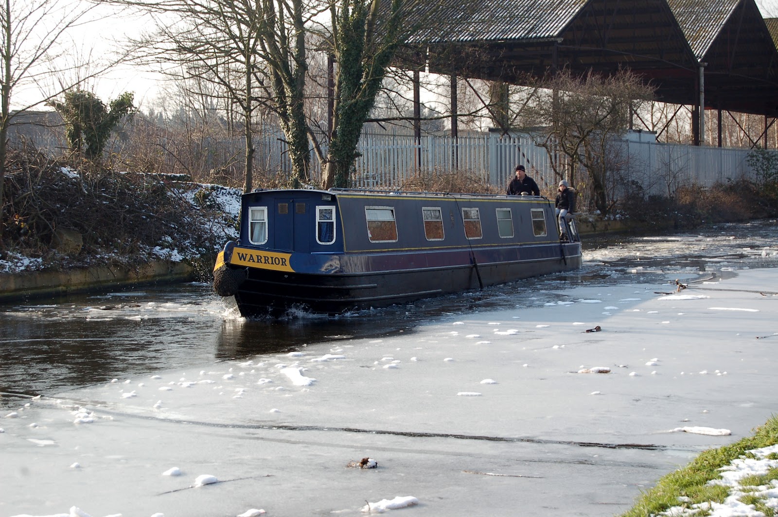
After the M4 the walk joins the Grand Union Canal as it winds its way from London to Birmingham. In parts the water had frozen over with only the odd gap under bridges and where rivers and surface water drains pour warmer water into it. It was quite amusing to watch coots come flying in, land on the ice and skid, sometimes backwards, for some distance before colliding with the bank or one of their fellow canal dwellers. Most boats were moored up for the winter, their owners working on maintaining the boats for the summer season. One or two were working their way through the ice though, dramatic cracking sounds as the metal hulls forced their way through the ice.

The path swings away from the canal for a time through Stockley Park, a modern science park. Very icy paths through here were snow has melted and refrozen on the tarmac paths. Back to the canal the path goes close to West Drayton, where I taught for five years, before leaving the main Grand Union for a short stretch along the Slough branch of the same canal. At the junction is a huge marine crammed with canal boats of all colours and sizes and a haze hung over it from the stoves that were running on some of the boats.

The path then joins the River Colne as it runs through an area of former brickworks which have been flooded. The area was famous for its bricks and the canal was used to ship them into London in their millions. Passing through a wooded area I caught a glimpse of copper and turquoise as a kingfisher exploded from the river and landed on a branch with a small silver fish in its beak. I started to creep closer but before I could get very far a car door slammed and it was off. I saw it again a couple of hundred of yards later but again too far away to get a decent photo. This probably was the best moment of any of the walks I've been on, you don't get to see a kingfisher everyday in London!

This sight kept me going through a slightly grotty leg where the path runs between tangled branches and a high metal fence before a short road stretch leads you back to the canal and the final walk towards Uxbridge. By now I was feeling very cold where the bustling high street and tube station were very very welcome!

Sunday, 26 June 2011

London Loop: Section 2: Old Bexley to Petts Wood

Weather: Fine, sunny and warm
Playlist: LastFm Playlist
Time: 2.5 Hours

Bit of a delay blogging this walk - busy times at work. However this was a fantastic walk and I would heartily recommend it to anyone. Although not as long as some sections it crams in a lot of attractive features. The walk starts out from the attractive Old Bexley that I'm sure would repay more time exploring than I gave it. Soon after leaving Bexley you head up over a grass covered waste dump, no don't turn back, this was filled with wild flowers and several skylarks that danced in the air and sung in the summer sun. Fantastic. There were clumps of wild fennel with beautiful bronze fronds some 3 feet high beside the track and again it was hard to believe that this was London not somewhere wilder. The path then goes past cricket pitches where a host of youngsters were playing various forms of cricket. One young girl thwacked a ball almost over the fence as I was passing so take care on this leg if you are walking in the summer!
The next section is alongside the River Cray which here is very pretty and filled with little brown fish. My fish identification skills are even worse than my bird spotting talents so I can't tell you what they were! The Cray is held back by a weir under the attractive Five Arch Bridge and spreads out into a placid lake upon which swans with cygnets along with coots and moorhen with their young paddle around.
Five Arch Bridge
The path continues along the river through the meadows past the attractive Sidcup Place before negotiating the junction of the A20 and A222 - a bit of a maze but well signposted so I didn't get lost. Most of the rest of the walk is then in dappled shade through mixed woodland, up and down hill along clear paths possibly some of my favourite walking. The woods were full of jays (or the same one that kept coming back and flying past again).
The last part for the walk gave views over rolling hills with sheep grazing in the sun. Great stuff and can't wait for the next leg in early July.