Showing posts with label football. Show all posts

Sunday, 7 August 2022

Tracking the Tube: Victoria Line 2: Walthamstow Central to Kings Cross


Weather: Blooming Scorching!
Distance Walked: 17.85 km
Distance By Tube: 11.4 km
Stations Visited: 7
Fantastic Place: Woodberry Wetlands


Only 7 stations so I've added the old H&I station for fun.
 
My tube walks are sadly becoming annual events rather than monthly as they used to be. I need to take time out to do more a year, perhaps shorter legs rather than the long ones I've done in the past. 

Today saw the completion of the Victoria Line and I was pleasantly surprised by what I found on this hot sunny summer day. Those of you paying attention may have notice that this year has been one of the hottest and driest on record (a week or so ago we hit 40c which was rather too warm for my tastes!). So the 27c temperature and clear blue skies were not a surprise, I was thankful for the modern water fountains installed by our current London mayor so I could top up my water bottle at regular intervals. Patches of grass on roadsides and parks were a uniform khaki colour and trees, especially horse chestnuts, were already shedding leaves.

The walk started in Walthamstow, former home of William Morris, there is still a museum dedicated to him near the start of the walk. One striking feature of the area are bollards.Most of them seem to have been dressed in woolly jumpers to protect them from the cold - they must have been sweltering in the heat!

Bollards keeping warm

Walthamstow - proud of its heritage

Just past Blackhorse Road station, where there are a lot of new residential tower blocks being built the route continues along a level, straight causeway between two large reservoirs, part of the Lee Valley Reservoir chain. These provide drinking water for London and are also now a important site for water birds such as cormorants. I could see there were footpaths leading around the edges of the water which may make for an interesting visit for the future. On the west side of the reservoirs is the Walthamstow Wetlands. Even from the side of the road I could see that this would be a great place to visit if you like wetlands and wildlife (also a nice looking waterside pub!).
 
Heron on guard duty

 More building and development could be seen near Tottenham Hale station and much light industrial. At this point I should mention that the stations on this leg are nothing to write home about architecturally - the 60's eh!
 
The next leg along Seven Sisters Road was fairly grim, I may have gained a kilo from all the pollution I breathed in so I was quite glad to turn off the road and go rural for a bit . In fact the next section was one of the best bits of any of my tube walks so far. The Woodberry Wetlands is a little lung in this polluted and overcrowded part of London. Two large reservoirs and waterways with birds and plants providing a welcome respite. It also provided lunch at the Coal House Cafe.  I had a very nice cup of coffee and a cheese and fig chutney toastie that set me up nicely for the rest of the walk. The cafe and the wetlands are well worth a visit and are only a short walk from Manor House station (Piccadilly Line - hmm perhaps I will pop in again when I do that line!)


The wetlands have been built in conjunction with a housing development, lots of flats with balconies overlooking the water and a rather nice water feature.


It was back to the Seven Sisters Road for the next station Finsbury Park and the more suburbia before a detour to one of the temples of football the old Arsenal football ground at Highbury (the other is of course the magnificence that is Fratton Park home of the mighty Pompey). Now converted to flats the listed stands still tower above the streets. Down the hill the new Emirates stadium can be glimpsed awaiting a future walk. 

 
The path continues through Highbury Fields, very nice open space but looking very scorched and brown in the sun at the moment. I then got rather twizzled around at Highbury and Islington station, the heat getting to me at last! The last few kilometres were a bit of a grind at the end of a long hot walk but I did pass through a very pretty square surrounded by flats, possibly Edwardian in age which had very nice Gothic details around the windows and doors. 

So that brings to an end the Victoria Line. Now to decide which of the remaining lines to do next and how to break them up in a sensible way!


Tuesday, 30 July 2019

Tracking the Tube: Jubilee Line 04: Neasden to Stanmore


Weather: Very Warm
Distance Walked: 17.01 km
Distance By Tube: 10.2 km
Stations Visited: 6
Fantastic Place: Canons Park


Another year and finally I've completed the Jubilee line.

Guess who forgot to photograph Stanmore Station!
I wasn't looking forward to this leg. From the map it looked like a tough start finding a route next to the very busy North Circular Road and then on through a busy industrial area. This would be followed by lots of dull suburbia walking beside more roads. Now that I only do a few walks a year I'm getting more fussy about the ones I do do and in some ways I resented that this would be possibly one of my final walks of the year.
I wasn't wrong about the start! Grim walking by very busy roads with lots of pollution. At least I had scanned Google Streetview for the start and spotted the alley that took me alongside the A406. Then more walking through light and medium industrial areas, including cement works, and building site after building site. But even here there were moments of beauty, a trailing passionflower draped over a metal fence and a sculpture of a dandelion clock over the River Brent. 
Don't think I'll blow on this one!

The Brent looking rather pretty
I would have liked to get closer to Wembley Stadium but the whole area appears to be one large construction site where flats and apartments are being built in their hundreds if not thousands. I managed to glimpse the arch and had a view back along Olympic Way but that was about it. Some day I will go to a match at Wembley, I can see it from the windows of our loft bedroom and when lit up I can see it when I walk up the hill from Greenford Station, but despite living in London for 30 years I've 'not got round to it.'
The Arch

Olympic Way

New hotel going up alongside Olympic Way

Once past Wembley Park station things got a lot better, less building sites and nice front gardens. Even better was the open expanse of Fryent Country Park. A gentle climb to a ridge that overlooks this part of North London. 
Unlike Kate Bush I was not running up that hill

Damsons

This is London
Lots of mature trees and wide open spaces. At this time of year the hedgerows are full of blackberries, apples (probably from discarded cores) and damsons. Flitting round theme were lots of butterflies, moving to fast to photograph or identify though one might be a small brown. Several very happy dogs being taken for a walk seemed to be enjoying the summer sun and my spirit began to lift. After finding the way out of the park I dropped down into Kingsbury with it's busy row of shops where everyone appeared to be out. Lots of Asian and Caribbean shops with stacks of fresh fruit and vegetables, Asian sweetshops with their pyramids of golden delicacies and everything else you need on a high street. 

Continuing north towards Queensbury via the very attractive Queensbury Park where they have a set of outside exercise equipment. I think these are a good idea, shame they weren't in use. The park also had a nice wetland area with a pond nestling in the centre. The reeds and flowers were busy with dragonflies. with swifts flitting across the water hunting for insects.
Urban wetlands - a vital resource for wildlife

After Queensbury station, a smaller quieter version of Kingsbury, I continued north to Canons Park station and the park of the same name beyond it. This turned out to be the highlight of the walk even thiugh the walled George V memorial garden was closed.


Geoge V Memorial Garden

More building works around Stanmore station, this time for retirement flats, and then a handy bus home after what turned out to be a very pleasing walk.  
So another line has been completed so I'll need to give some thought to what I do next. Waterloo and City for a quick jaunt during the winter? The H&C line, most of which has been done as part of other lines? The Victoria Line which should be able to be knocked off in a couple of days? Or the more substantial PIccadilly Line where it doesn't run alongside the Met Line given that the Central line is being left last? Answers on a postcard to the usual address!

Wednesday, 1 July 2015

Tracking The Tube: District Line: 04: Monument to East Ham


Weather: Very Warm and Humid
Distance Walked: 16.68km
Distance By Tube: 10.73km
Stations Visited:12
Fantastic Place: The Tower of London


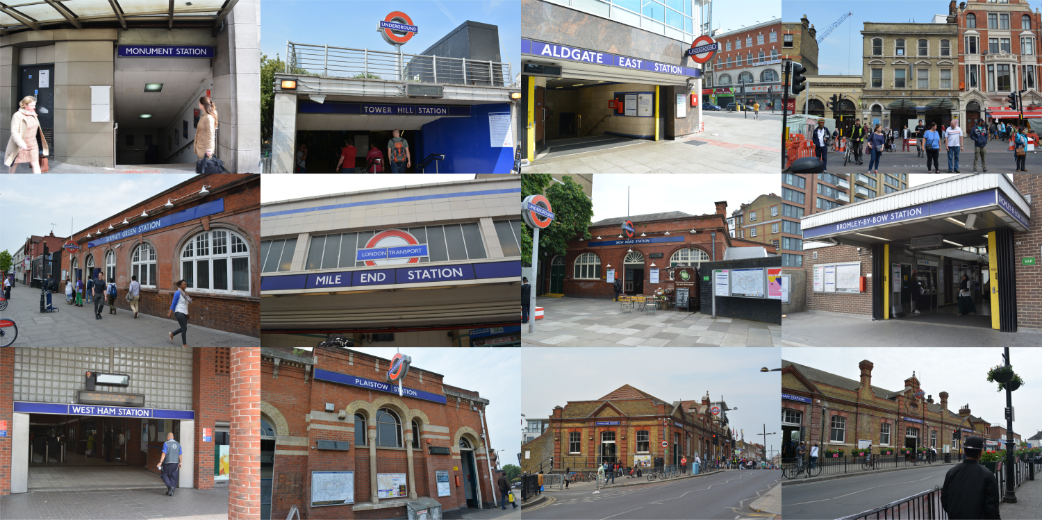
12 Stations on this leg with no coherent design

I was already working up a fine sweat by the time I arrived at Monument on what was the hottest day of the year so far and the tube was busy with people in suits rushing to become something in the city while I was wondering how far I was going to get on my journey into the uncharted regions of the east. Actually, not so uncharted to be honest as I hadn't noticed that one stretch of the walk was along the Greenway. If I had I would have also noticed that the Greenway was closed for part of that stretch for engineering works and it would have saved me a couple of tiresome detours, but more of that anon.

After leaving Monument station (having this time been directed underground from bank up and down untold numbers of short flights of stairs and escalators) I headed towards the Tower of London. I remember going in there when I was young but haven't been in since I moved to London as it is so expensive. The area around the Tower has been tarted up a bit since I last walked through and you can get a good view of the buildings from the walk up towards Tower Hill station.

Buildings Ancient and Modern
You can also see of my least favourite modern towers - the 'Walkie Talkie' and the 'Cheese-grater' as you look back to the city. 

The Tower of London
I used to have a brown plastic money box in the shape of the Tower of London, I imagine I bought it when I taken there by my sister.

Emperor Trajan by the Roman Walls
There are quite a few remains of the old Roman Walls in this area (which may be an interesting theme for a series of walks for the future - tracing the old boundaries of London, Roman, Saxon etc.)

Attractive Victorian Pub 

After passing through building sites and narrow alleys I reached Aldgate East, a station that appears to have an inordinate number of entrances; one very modern, one less so and the original one tucked into what I thought was a library. Mind you at least I didn't walk past it like I did with Whitechapel station as it was almost invisible on the other side of the road (and I had forgotten that it existed and hadn't marked it on my route map)!

The Whitechapel Road follows the route of an old Roman road heading out to Colchester and parts of it look like they haven't been resurfaced since then while other parts are undergoing major roadworks. I have never seen so many cones and orange plastic fences! The walk follows this road all the way to Bow Road.

Don't think is a real ancient column

Now my pencil ran out about here so I don't have many notes to remind me of what I saw or where I saw them. This combined with the heat and humidity may make the rest of this commentary a little odder than normal.

After Stepney Green station the route passes under Mile End Park where they have built a green bridge over the road linking the two haves of the pub just after the road passes over the Regent's Canal.


View down the Regent's Canal

Green Bridge linking two halves of a park. Note the cones!
Just before this I passed Queen Mary College, a fine set of buildings both ancient and modern including some nice bas-relief work showing various arts.

The next section was one of my least favourite so far. Very hot and alongside the very busy A12 south towards Bromley By Bow station then back north looking for an underpass across to the far side of this major trunk road.

Once through a light industrial estate you enter the River Lea valley a collection of riverways and canals, a peaceful change from the roads barely a hundred yards away.

Three Mills
Amongst the buildings here are 3 Mills Studios where I notice Masterchef is filmed (spotted the bridge I walked over on the credits for this week's episode).

As well as the canal architecture, peaceful waterways with birdsong and views across to the Olympic Park there is quite a bit of sculpture lining the route.

Memorial to workers killed by bad air

Not sure who this was

After getting lost, retracing my steps and then having to re-retrace them when discovering that the Greenway is partially closed I eventually reached West Ham station before rejoining the Greenway for a stretch. The views from the Greenway are splendid and it should be far better known and used than it is.I took an ill-advised short cut to Plaistow station ending up walking the same distance but in less interesting surroundings before heading on to Upton Park. Couldn't resist taking a shot of the Boleyn Ground on y way. As I was heading up to Upton Park station (prettiest station on this leg by the way) I saw what I assumed to be a traditional East End funeral; a horse drawn hearse with black ostrich plumes and a train of six or seven long black limos.

Upton Park / Boleyn Ground Home (for now) of West Ham United
The last stretch to East Ham was enlivened by a long conversation with Pat, a long standing resident of the area who questioned what I was doing (something I do regularly). We chatted for at least half an hour, my legs slowly stiffening but we bonded over politics and the poor manners of the younger generation (I was a little annoyed to be be classed as the same generation as her!).

I hope to be able to complete the rest of the District Line on y next walk which will take me through Barking and out to the utter east.


Sunday, 15 March 2015

Tracking The Tube: District Line: 02: Edgeware Road to Wimbledon


Weather: Nice and sunny but with a bit of a lazy wind
Distance Walked: 20.8
Distance By Tube: 15.09
Stations Visited:15
Fantastic Place: West Brompton Cemetery


15 Tube Stations on the leg of the walk

For the second leg of my District Line walk I skipped a bit eastward so I could do the other north-south branch from Edgeware Road to Wimbledon, fifteen stations including a detour to take in Kensington Olympia on it's seldom used branch line from Earl's Court.

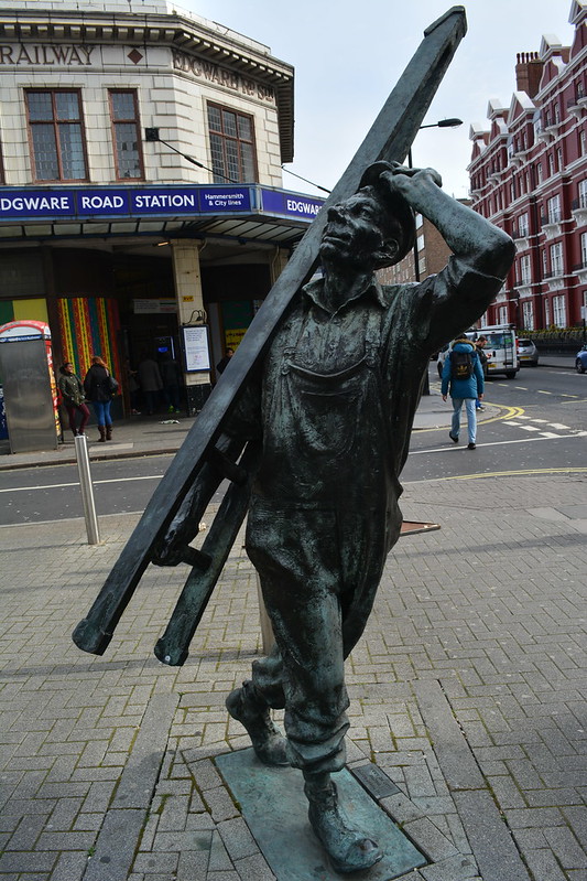
There are two Edgeware Road stations, this is the more attractive of the two and has what appears to be the standard, for this part of the line, pale cream glazed brickwork frontage. Interestingly this station was originally part of the Metropolitan railway but now serves the District, Circle and Hammersmith & City lines. Just outside the station was the first of two interesting pieces of public sculpture I was to see on this section of the line.

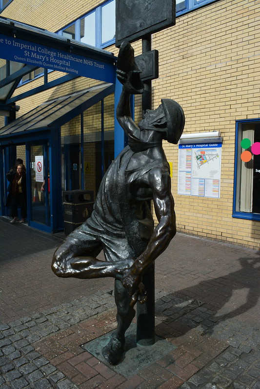
 The stretch down to Paddington Station passes through the sprawling buildings of one of London's teaching hospitals, St Mary's, very useful if you are playing a game of Pointless in your head trying to find words beginning with a vowel and ending with 'ology'.

Another sculpture outside of the hospital of a cyclist checking his shoe. Odd.

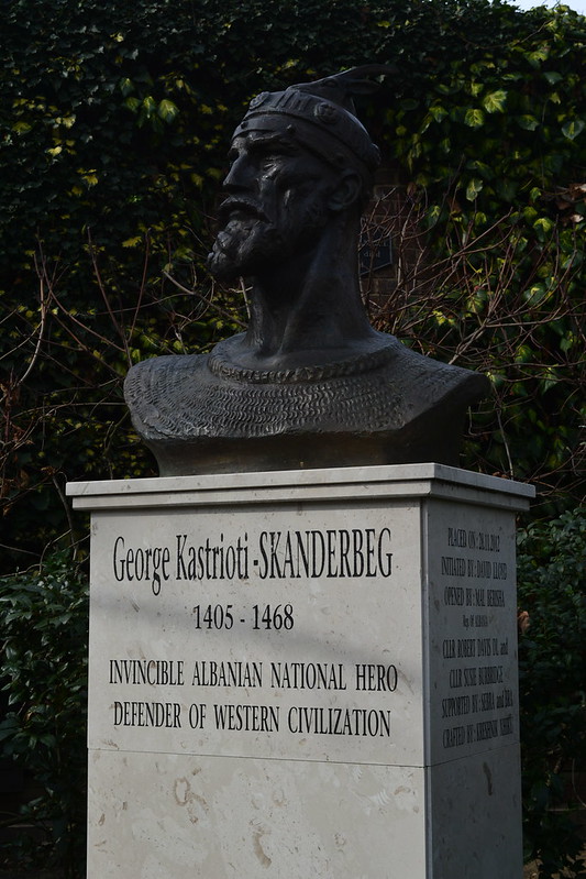
Through the seemingly endless streets of Bayswater lined with stylish mansion flats and squares filled with spring bulbs and early cherry blossom in shades of pink and white and on the corner of one of these streets, the rather fine bust of George Kastrioti-Skandburg.

Bayswater station followed soon after and I was soon in little Athens with a domed Greek Orthadox cathedral and lots of Greek grocery shops.

After Notting Hill Gate station my path took me along Kensington Palace Gardens, part of the Crown Estate, and signs told me in no uncertain terms not to take any photos. Again this was useful practice for Pointless as I tried to guess the embassy from the flag flying outside. Some were simple, Japan, Finland, Russia, others less so, Nepal for example. Israel's was probably the easiest to identify as it was the only one with two Met police officers armed with semi-automatic weapons standing outside.

I moved swiftly on...

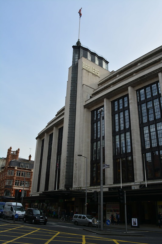
High Street Kensington was busy as lunchtime was approaching and there were plenty of interesting buildings in the Art Deco style to admire as I headed back west towards Kensington Olympia. The most striking building was probably Barkers.

The old Commonwealth Institute is being knocked down / refurbished to become part of the design museum. It was one of the first museums I went to when I moved to London, an interesting building but prone to leaks if I recall correctly. 

Kensington Olympia doesn't have a proper sign so I included in the montage the sign that gives it's original name Kensington Addison Road instead.

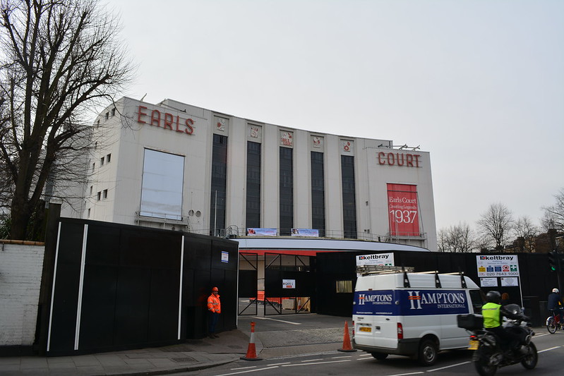
Heading south east the streets are busier and everything appears a little more shabbier as I arrived at Earl's Court. This was where I saw my first gig, Pink Floyd performing "The Wall." Now the whole exhibition centre is being knocked down to provide non-affordable housing. Shame, many great memories have seeped into the concrete walls of that edifice.


West Brompton is the next station, from the top floors of the nearby Empress State Building (a former client was based there for  time) you have a great view down onto the pitch of Stamford Bridge, home of Chelsea Football Club.

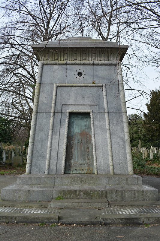
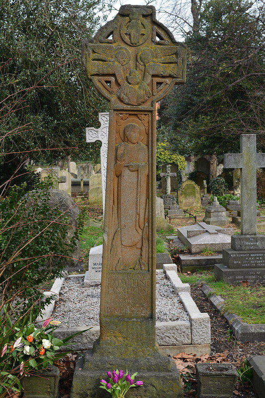
The next stretch takes you through the slightly wild and overgrown West Brompton Cemetery. Lots of  family tombs, vaults and mini-mausoleums line the main route including the grave of Emmeline  Pankhurst. Some of the tombs would make great entrances for a Dungeons and Dragons game!

After leaving the cemetery you walk round the perimeter of the football ground which sprawls around a bit. The outside of the complex itself is rather an ugly monstrosity at ground level and looks better from above.

The original Fulham Broadway station was a grand brown stone building but this is now closed and the station is buried within a steel and glass shopping centre. Ho hum.

Passing over the interestingly named Eel Brook Common open space, past Parson's Green station and then Parson's Green itself I felt a little deja vu as this reminded me of the Turnham Green and Chiswick Park section with small common areas with the tube line running on an embankment close by.

Putney Bridge station followed soon after and then up a flight of steps to a footpath that runs alongside the train tracks across the Thames, the tide was out, with great views down the river.

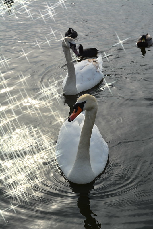
South of the river the stations change in style, becoming quaint brick built buildings with the logo of the London and South West Railway above the entrance in carved brickwork along with the date of opening (around 1889-1890) the same date as the building of the railway bridge. Past Southfields the route enters Wimbledon Park which I visited on the Capital Ring walk. The pond was full of ducks and swans being fed by young children well wrapped up against the wind that blew unobstructed across the water. But with the sun reflecting off the ripples and the bulbs and blossom on the trees this was a very enjoyable respite from the suburban streets surrounding it.


Somehow the rod climbs steeply from Wimbledon Park station up Arthur Road to the last stop on this leg of the walk Wimbledon Station.

Next I will return to Turnham Green and explore the District Line as it follows the line of the Thames through the city and out the other side into the lesser known, to me anyway, reaches of Dagenham and Upminster.


Friday, 1 August 2014

Tracking The Tube: Bakerloo Line 01: Harrow & Wealdstone to Kilburn Park


Weather: Very sunny, warm and humid
Distance Walked: 21.2 km
Distance By Tube: 13.2 km
Stations Visited: 10
Fantastic Place: Mentmore Close


This was not the most inspiring of lines to walk. Most of the northern stretch of the line lies within 1930s suburbia, numerous terraces and associated light industrial units and the North Circular. Still there must be some highlights. In desperation I turned back to Mark Mason's "Walk the Lines" the inspiration behind this project. I spotted that not far 'off the cotton' was the scene of one of my favourite comedy moments so noting that on my route plan I shrugged on my rucksack and set off.


Most of the northern part of the line is shared with mainline services hence the stations are large and lack the traditional Underground architectural aesthetic (ooo get him!). It is not  until I reached Kilburn Park at the end of this leg that I got to see a 'traditional' station building.

Harrow & Wealdstone station has an interesting mural produced by local school children marking the Millennium and all the famous events that have happened in the area. This included a record of the major train collision that happened in 1952 which led to a raft of improvements in rail safety. On the subject of the railways it is worth reading Christian Wolmar's books in particular "Fire & Steam" and "The Subterranean Railway". Both are written in an entertaining style and bring across the chaos and corruption of the early years of the industry.
Walking through light industrial units beside a busy road towards the pleasent open spaces of Kenton Recreation Ground I passed a gloriously colourful Hindu wedding party that lit up the grey drabness of area. The car parks were full to bursting and lots of people were sitting eating rather tasty looking food.

Passing Kenton Station I diverted from the direct route to visit Mentmore Close site of this classic comedy moment.


It would be easier now with the dropped kerb but he'd need to watch out for the bollards.

Should have a blue plaque if you ask me!

The whole estate, in particular the nearby Northwick Circle is an attractive area. This is another of those places I'd never been to nor did I realise that Kenton and Northwick Park stations are so close together, no more than a 5 minute walk yet by tube it would take the best part of an hour and a change of trains at Baker Street!

My route then took me under the tracks at South Kenton where I had a case of deja vu  - this is also the route of the Capital Ring. On to North Wembley through more nondescript suburbia and on to Wembley Central. I'll associate much of this part of the walk with the smell of bins, Friday being collection day, and the large wheelie bins parked on the pavement and in the small front yards were warming up nicely giving off that fragrant aroma you get with heated seepage at their bottom. These seepage has now been given the name farage in one of the 'urban dictionaries.'

Wembley Central has been undergoing building works for some time so I've no idea what the station used to look like hence the rather odd photo! Onwards we travel between high metal fences beside a playing field with Wembley Stadium in the distance.


Stonebridge Park is one of those places I've driven past too many times to mention as it lies on the North Circular road. As a pedestrian it is a maze of road crossings, semi-derelict office blocks and numerous railway lines. The station is up a cul-de-sac and is another of the brick shed style of buildings I've seen before on this leg, Harlesden next up is another. Leading up to Stonebridge Park you pass through the area known as Tokyngton "the farm of the sons of Toca" - not much farmland around now though.

I considered walking along the Grand Union Canal between Stonebridge Park and Harlesden but this section runs through more industrial buildings than you can shake a stick at and may not have been any more interesting than the more direct route.

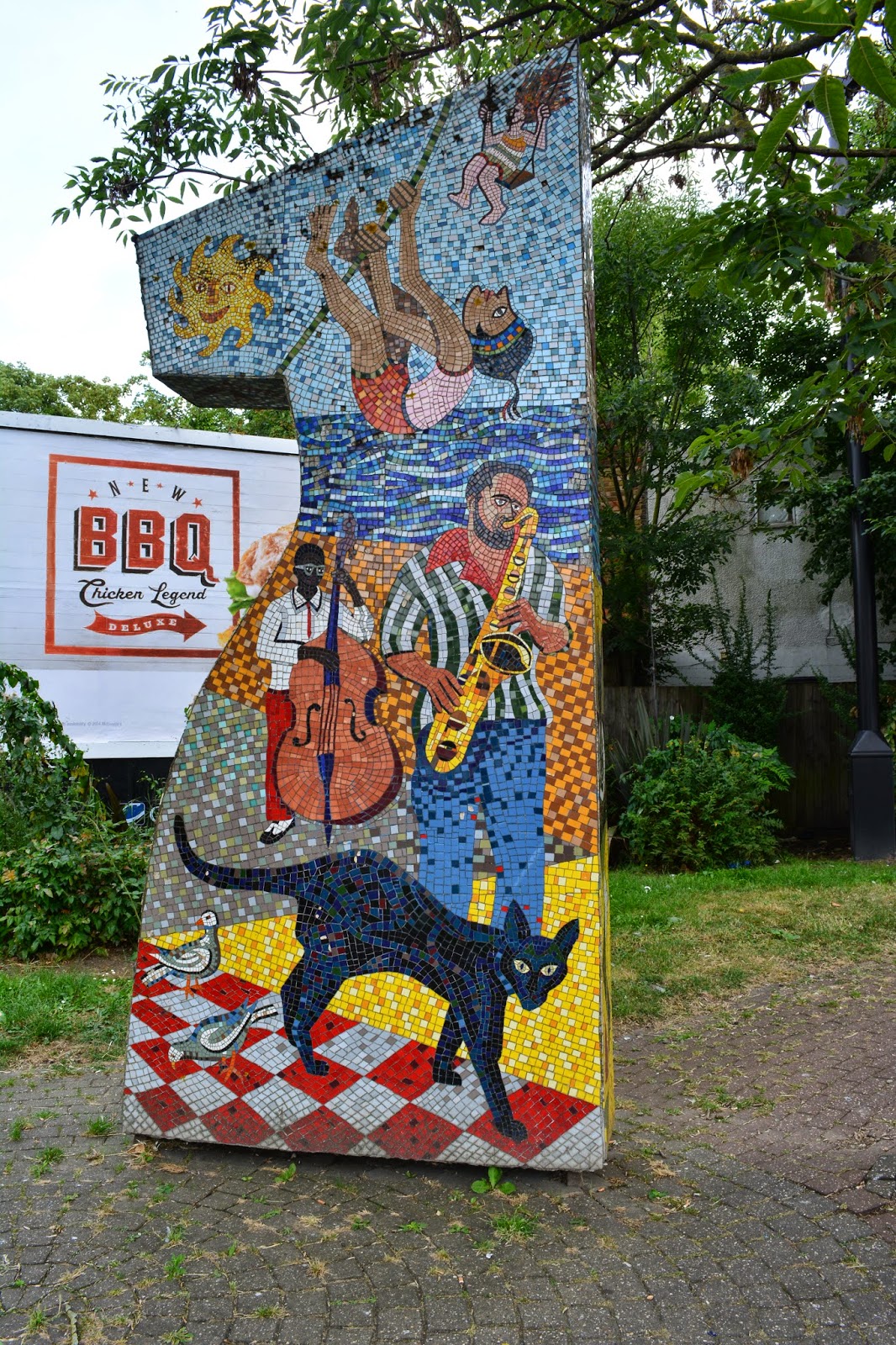
After Harlesden I came across some attractive mosaics at the junction of Acton Lane and Minet Avenue.


Willesden Junction is a complicated station with lines and platforms running in all directions (which is why it is called a junction I suppose). Took me a while to work out which way to go through the station to end up at the correct exit onto the Harrow Road towards Kensal Green. Willesden Junction is the first of four completely different designs of station. In this case quite modern ticket office on a higher level above the more traditional style platforms. Kensal Green is like a wooden chalet, Queens Park a strange metal box and finally Kilburn Park the first of the traditional blood red tile constructions typical of the main part of the old Underground network.

The walk from Kensal Green to Kilburn Park started to lead into more 'upmarket' properties with gastropubs, the odd art gallery and many eateries. Portuguese restaurants were fairly common, I normally associate Vauxhall where I work with Portuguese shops and cafes but it appears there are at least two little Lisbons in London.  Just before Queen's Park, the area named for Queen Victoria, there is a very pleasant park with an active local preservation group where the QPR football club started.


Next leg will hopefully be more interesting as I head through the heart of the city and out the other side.